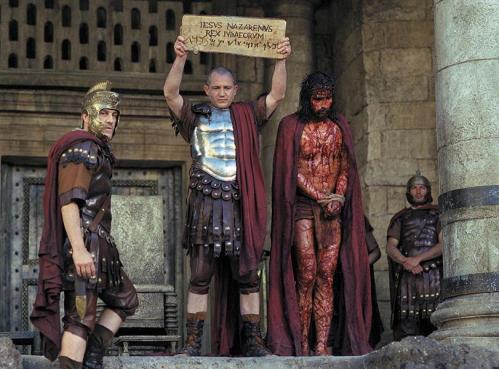
Rock (Lithostrotos) where Jesus was judged
Massive Challenge to Standard Geography of Jerusalem – Temple
Part Four:
Dr. Ernest L. Martin on the Lithostrotos
“Later, in the time of the Piacensa Pilgrim from Italy … this “Praetorium” had
a singular feature that was honored by the Christians. It was an “oblong Rock”
on which Jesus stood when he was judged by Pilate”.
Ernest Martin
Lithostrotos (Greek) or Gabbatha (Hebrew)
According to Abarim Publications:
“The name Gabbatha occurs only once in the Bible. It’s the name of the location where Pontius Pilate had his judgment seat, also known as Lithostrotos, meaning stone-strewn (John 19:13). Pilate tried to reason with the Jews with the objective to let Jesus go, but was left little choice when they began to evoke Caesar’s sovereignty. It was from Gabbatha that Pilate delivered Jesus to be crucified (John 19:16)”.
Dr. Ernest L. Martin referred several times to the “Stone Pavement”, or Lithostrotos, when he wrote an answer to Dutch-born archaeological architect Dr. Leen Ritmeyer (“A Critique by
Dr. Leen Ritmeyer. Rebuttal by Dr. Martin”).
I (Damien Mackey) do not necessarily accept the following AD dates or supposed associated history as provided below by Dr. Martin:
….
Josephus said the Temple of Herod was built high up on a platform that had four walls around it forming a precise square of 600 feet on each side. This description in no way fits the dimensions of the Haram [esh-Sharif]. Josephus said the wall of its southeast corner had its foundations directly in the deepest part of the Kidron Valley (in the streambed itself) and that its height was 300 cubits (450 feet, or about the height of a modern 40 story building). Near the northwest corner Josephus said this external Temple wall was connected to Fort Antonia by two side-by-side colonnade roadways (each 600 feet long). Josephus then said that Fort Antonia itself was built around a notable “Rock” that was viewed as the centerpiece feature of the interior of the Fort (which was also known as the Praetorium). This well-recognized “Rock” in the Praetorium around which Fort Antonia was built was called the lithostrotos in the Gospel of John (19:13) and Christ stood on it when judged by Pilate. Josephus said that Antonia’s size was much larger than the Temple (he described Fort Antonia as the size of a city and it contained a full legion of Roman troops with many open spaces for military exercises and training). Fort Antonia was so large that Josephus said it obscured the whole of the Temple square from the north. These plain and simple descriptions made by Josephus are depicted in the drawing that Ritmeyer dislikes and they are in precise accord with what Josephus (as an eyewitness) states in the clearest of language.
Another eyewitness account was given by Aristeas in 285 B.C. He said the Temple at Jerusalem had within its precincts a natural spring of water, and Tacitus the Roman historian in 100 A.D. also mentioned this inexhaustible spring that was located within the walls of the Temple just before its destruction by the Romans. In my replication in BAR, the professional artist was able to comfortably fit the 600 feet square Temple with its 40 stories high platform as being located over the Gihon Spring (the only spring of water in Jerusalem within a radius of five miles). It was also simple and very logical to show the two colonnade roadways near the northwest angle of the external Temple wall extending a further 600 feet northward to intersect with the southwest corner of Fort Antonia. All geographical features mentioned by Josephus, and incorporating the eyewitness account of Aristeas, and the statement of Tacitus (and by other eyewitness accounts that I have recorded in my book “The Temples that Jerusalem Forgot”) fit precisely into place as shown by Josephus. To be sure of the truthfulness of the drawing, the artist reviewed the latest editions of Josephus’ literary works to scrutinize each geographical feature in a precise way. It took a month of fine detailed research to come up with the final drawing. This drawing is accurate. Since that time (four years ago), numerous scholars have painstakingly gone through those geographical details given by Josephus (which I would ask Ritmeyer to do) and they have come to the identical evaluation that is displayed in the drawing in BAR that Ritmeyer finds offensive.
In the drawing we are only reproducing what Josephus stated with utmost precision. Ritmeyer knows of these profound differences in all points but dismisses them by stating that Josephus was wrong in what he stated.
The truth is, Josephus was describing a different building not even associated in a geographical sense with the area of the Haram esh-Sharif.
This is a sad commentary on the state of archaeological appraisal on these matters. It is time to accept Josephus’s descriptions exactly! I challenge anyone to read what Josephus wrote (along with the other eyewitnesses) and honest scholars will admit that what is shown in the drawing will be vindicated. What irritates Ritmeyer is the fact that this description of Josephus cannot show the Temple to be located inside the Haram esh-Sharif where he wants it to be. The true placement of the Temple (as the historical eyewitnesses state) is over the Gihon Spring that is about 1000 feet south of the Dome of the Rock that was built over the present centerpiece “Rock” of the Haram esh-Sharif. Indeed, if one would simply accept Josephus’ description of the Temple (with his plain and simple measurements) and then position the Temple over the Dome of the Rock where Ritmeyer demands, one would witness a square building 40 stories high with the platform of the Temple higher in elevation than the summit of the Mount of Olives! Ouch! Also, if Josephus’ Temple is placed within the Haram, the southeastern corner wall of the Temple would NOT be in the center of the streambed of the Kidron Valley as Josephus clearly attests it was. It would be on the level part of the ridge and not even near the edge of the Kidron precipice.
In fact, if Josephus’ measurements of the Temple and his basic description of it were accepted by all reasonable people (as they should be), to place the Temple within the Haram esh-Sharif that Ritmeyer insists is proper would make a platform so high that no one from the Mount of Olives could look down into its courts as was an essential part of Temple rituals. On the other hand, let the whole of the Haram to be reckoned as Fort Antonia (which it was), then we still witness Antonia’s four mammoth walls constructed over and around a notable “Rock” outcropping that Josephus said was the outstanding feature around which Fort Antonia was built. Without doubt, the Haram was Fort Antonia.
….
The word “Praetorium” was often synonymous in meaning to a fort or an encampment (i.e. Fort Antonia).
Later, in the time of the Piacensa Pilgrim from Italy (sixth century) this “Praetorium” had a singular feature that was honored by the Christians. It was an “oblong Rock” on which Jesus stood when he was judged by Pilate. The footprints of Jesus were supposed to have been found in that Rock. A major Church called the Church of the Holy Wisdom had been built over the “oblong Rock” and remained there until the Persians destroyed the church in 614 A.D.
Then in 692 A.D., the Sixth Caliph, Abn el-Malik, built the Dome of the Rock over this “oblong Rock.” As late as the time of Saladin in the period of the Crusades, the court recorder of Saladin wrote that that “Rock” under the Dome of the Rock was the same “Rock” that always had the footprints of Jesus embedded on it that were left there when Pilate judged Jesus in the Praetorium (or, Fort Antonia). So, as late as the Crusades, it was known that the “Rock” under the Dome of the Rock was the lithostrotos (the structured Rock) mentioned in the Gospel of John (19:13) where Jesus stood at his judgment by Pilate. This evidence proves positively that throughout all the historical periods up to the Crusades it was recognized that the Dome of the Rock area in the Haram esh-Sharif was indeed the site of Fort Antonia, and NOT the Temple. ….


Comments